Latest Ocean News
〰️
Latest Ocean News 〰️
References & Further Reading
NOAA Fisheries. “Atlantic Highly Migratory Species: Shark Research & Tracking.”
https://www.fisheries.noaa.gov
NOAA Climate.gov. “Sea Surface Temperature Trends in the Atlantic.”
https://www.climate.gov
OCEARCH Shark Tracker. Real‑time tracking data for great white sharks along the U.S. East Coast.
https://www.ocearch.org/tracker
IUCN Red List of Threatened Species. “Sharks, Rays & Chimaeras Assessments.”
https://www.iucnredlist.org
University of Miami Rosenstiel School. “Rescue a Reef Coral Restoration Program.”
https://rosenstiel.miami.edu
Saving the Blue. Marine conservation, shark research, and rehabilitation programs.
https://savingtheblue.org
Fragments of Hope. Community‑led coral reef restoration in Belize.
https://fragmentsofhope.org
National Ocean Service (NOAA). “Climate Change: Ocean Warming & Marine Species Shifts.”
https://oceanservice.noaa.gov (oceanservice.noaa.gov in Bing)
Smithsonian Ocean Portal. “How Warming Waters Affect Marine Life Migration.”
https://ocean.si.edu
By Hillary Suddath
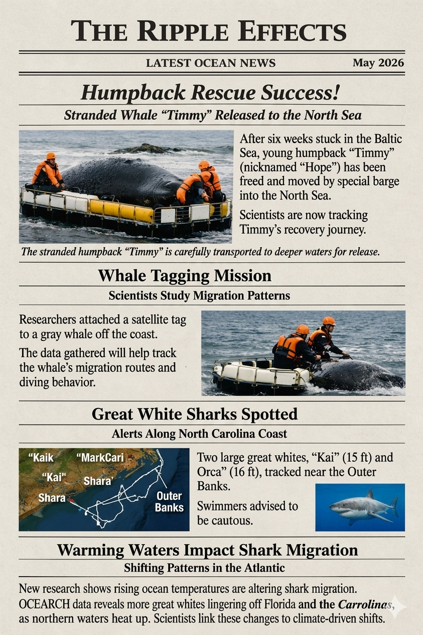
Humpback Rescue: Timmy’s Six‑Week Ordeal Ends in Hope
The latest from my perspective
For six long weeks, a young humpback whale nicknamed “Timmy” — later called “Hope” by rescuers — remained trapped in the low‑salinity waters of the Baltic Sea. Humpbacks are not built for that environment. The water is too shallow, too fresh, and too quiet for a species that relies on deep dives, cold currents, and wide‑open ocean space. Each day that passed increased the risk of organ stress, dehydration, and starvation. From my perspective, this rescue wasn’t just about saving one whale — it was about correcting a human‑made problem in a human‑dominated ocean.
After multiple failed attempts to guide Timmy out naturally, scientists and marine responders made a bold decision: transport the whale by barge around Denmark and release him into the deeper, saltier waters of the North Sea. It was a massive undertaking. Crews secured Timmy on a custom‑built cradle, monitored his breathing, and kept him hydrated throughout the journey. Once released, he swam off strongly — a moment that brought relief to everyone who had followed his story.
Timmy now carries a satellite tag that will track his movements, dive depths, and recovery. Scientists expect him to head toward richer feeding grounds as he regains strength. His journey is far from over, but for the first time in weeks, he is exactly where a humpback belongs: in the open ocean.
Whale Tagging Mission: Tracking Giants in a Changing Ocean
The scoop of the day
Whale tagging is one of the most valuable tools we have for understanding how marine mammals navigate a rapidly changing ocean. Recently, researchers successfully attached a satellite tag to a gray whale off the coast, using a long carbon‑fiber pole designed to minimize stress on the animal. The tag collects data on migration routes, dive behavior, water temperature, and feeding patterns — information that becomes even more important as climate change alters the ocean these whales depend on.
From my perspective, tagging is more than research. It’s a way of giving whales a voice in the scientific record. Their movements tell us where the ocean is warming, where food is disappearing, and where human activity is creating new hazards. Every data point helps build a clearer picture of how these giants are adapting — or struggling to adapt — to a world that is shifting beneath them.
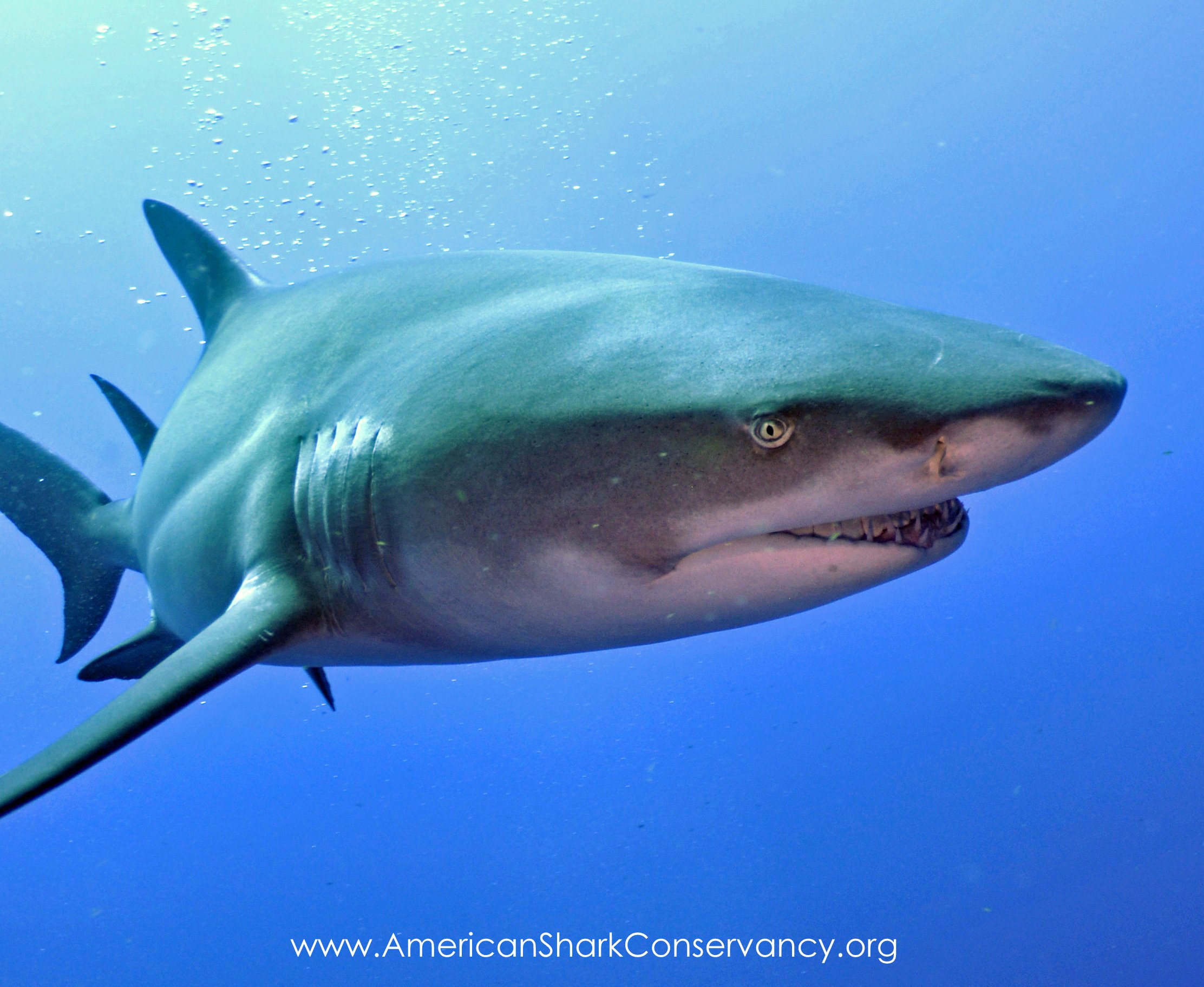
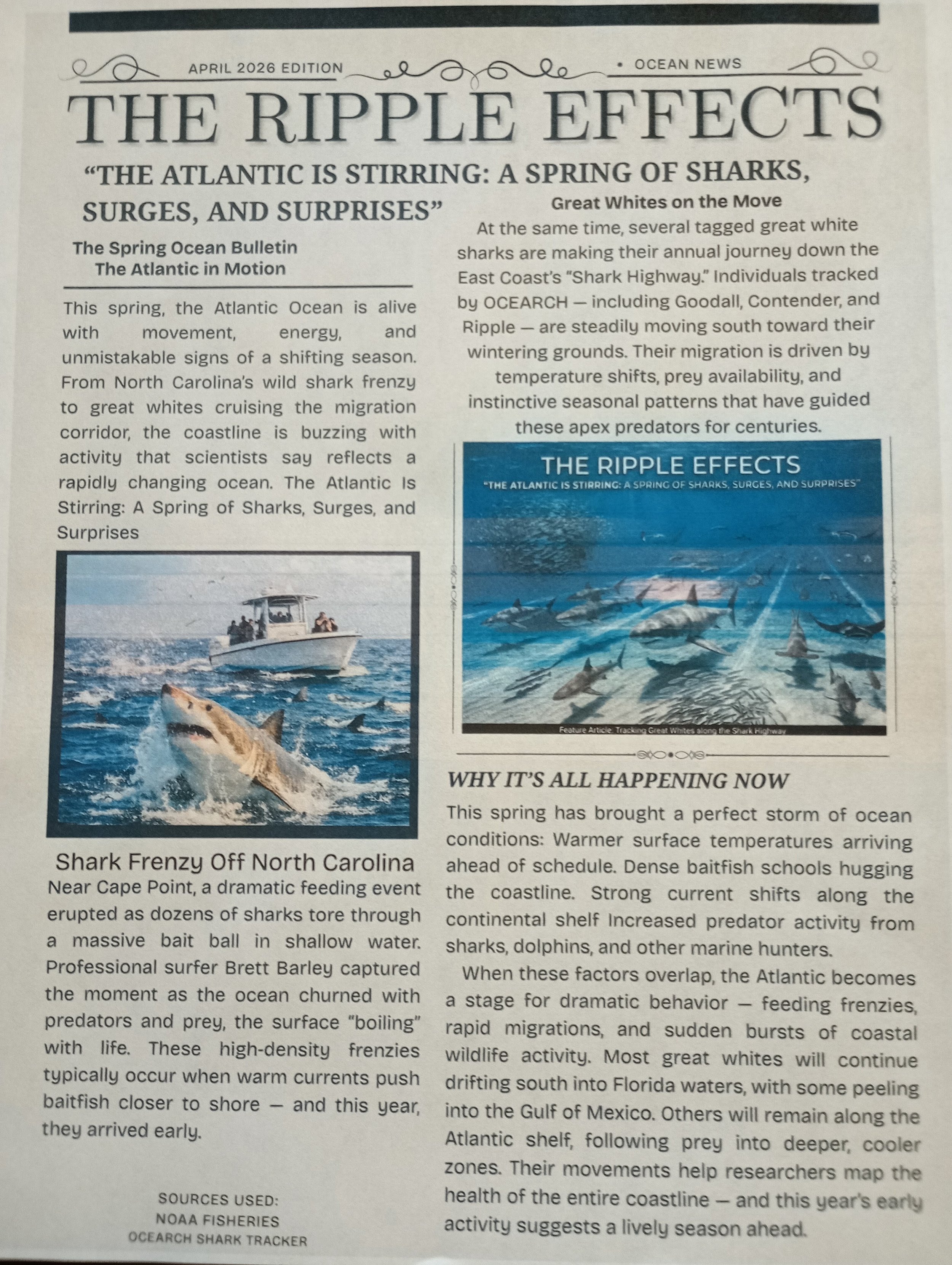
Great White Sharks Spotted off the Carolina Coast
The latest breaking news
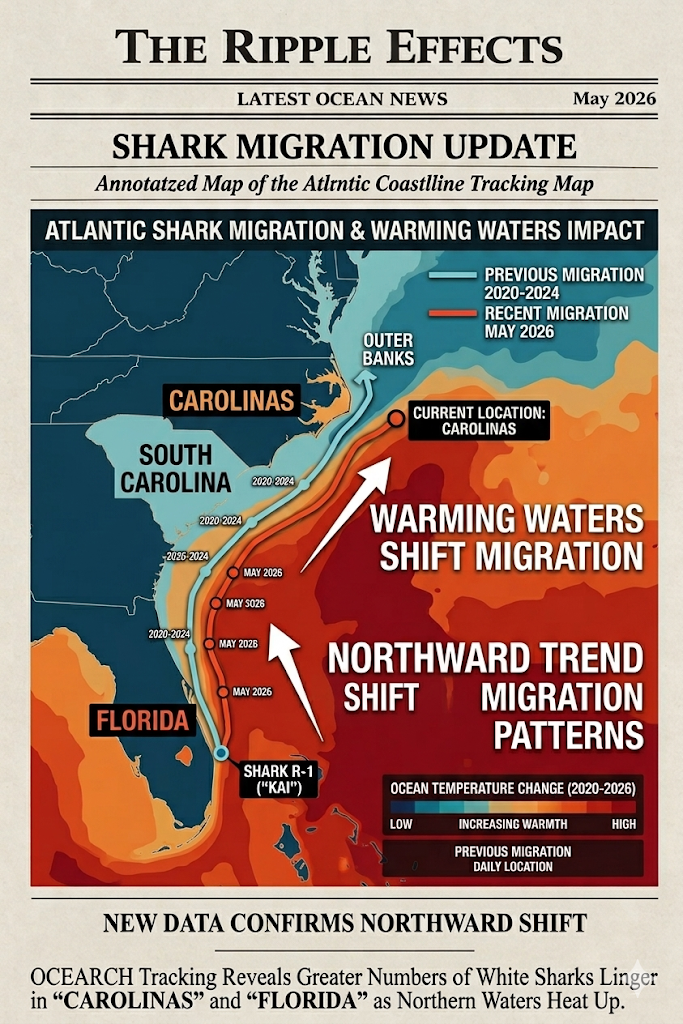
Two large great white sharks — “Kai” (15 ft) and “Orca” (16 ft) — were recently tracked near the Outer Banks of North Carolina. Their presence isn’t unusual for spring, but their proximity to shore has drawn attention from both scientists and the public. Great whites follow warm currents and prey species, and when those currents shift, the sharks shift with them.
Local officials issued caution advisories, reminding swimmers and boaters to stay alert. But from a scientific standpoint, these sightings are valuable. They help researchers understand how great whites move along the Atlantic coast and how warming waters may be influencing their seasonal behavior. Sharks are apex predators, and their movements often signal deeper changes happening in the marine ecosystem.
Warming Waters Are Changing Shark Migration
Recent research and shifting patterns
New research is revealing a clear trend: rising ocean temperatures are altering shark migration along the U.S. East Coast. According to NOAA’s long‑term sea surface temperature data, waters off Florida and the Southeast have warmed significantly over the past decade. As a result, some great white sharks are no longer traveling as far south during winter as they once did. Instead, OCEARCH tracking shows more individuals lingering off Georgia and the Carolinas, staying in northern waters longer into the season.
Scientists believe this shift is tied to several factors — warmer currents, changes in prey distribution, and the overall rise in ocean temperatures linked to climate change. These altered patterns make shark movements less predictable and may increase interactions with coastal communities. From my perspective, this research is a reminder that the ocean is changing faster than many species can adapt, and understanding these shifts is essential for both conservation and public safety.
Sources Used for this Newsletter:
NOAA Fisheries — Seasonal shark migration data
OCEARCH Shark Tracker — Current Atlantic shark locations
LiveNOW FOX — Fisherman risks life to rescue great white shark (April 2026)
New York Post — Surfer films shark feeding frenzy off North Carolina (April 2026)
Smithsonian Ocean Portal — Atlantic current and predator behavior overview
Pollution: Is the Drug World moving into the Ocean?
Further Reading :
National Geographic – Shark Facts & Conservation
<a href="https://www.nationalgeographic.com/animals/fish/facts/sharks"><u>https://www.nationalgeographic.com/animals/fish/facts/sharks</u></a>
NOAA – Shark Education Resources
<a href="https://www.noaa.gov/education/resource-collections/marine-life/sharks"><u>https://www.noaa.gov/education/resource-collections/marine-life/sharks</u></a>
IUCN Red List – Great White Shark
<a href="https://www.iucnredlist.org/species/3855/12329018"><u>https://www.iucnredlist.org/species/3855/12329018</u></a>
Smithsonian Ocean Portal – Sharks & Rays Overview
<a href="https://ocean.si.edu/ocean-life/sharks-rays"><u>https://ocean.si.edu/ocean-life/sharks-rays</u></a>
Australian Marine Conservation Society – Shark Conservation
<a href="https://www.marineconservation.org.au/shark-conservation"><u>https://www.marineconservation.org.au/shark-conservation</u></a>
Sharks swimming in the ocean wearing sunglasses
References
CBS News. (2026, March 26). Sharks in the Bahamas test positive for caffeine, painkillers and even cocaine, study finds.
Science News. (2026, March 18). Sharks are ingesting drugs in the Bahamas.
Wosnick, N., Herrera Agudelo, M. A., et al. (2026). Drugs in paradise: caffeine, cocaine, and painkillers detected in sharks from The Bahamas. Environmental Pollution, 396, 127818.
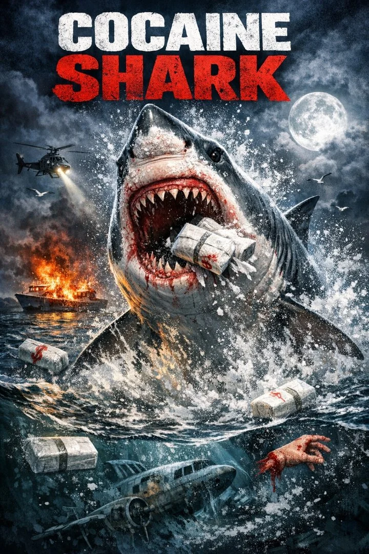
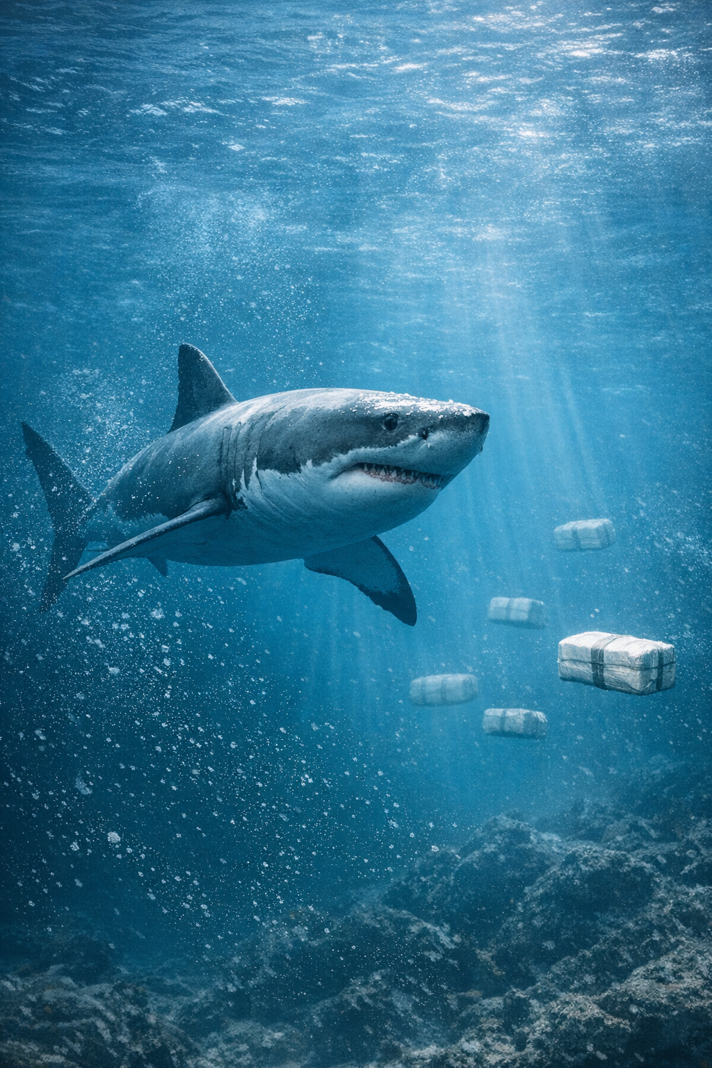
Cocaine Sharks: What the Latest Research Reveals About Human Pollution Reaching Apex Predators
When people hear the phrase “cocaine sharks,” it sounds like a joke or a movie plot. But the science behind the headlines is very real — and deeply concerning. A new peer‑reviewed study has confirmed that sharks in the Bahamas are carrying traces of cocaine, caffeine, and common painkillers in their bloodstreams, revealing just how far human pollution has spread into marine ecosystems (Wosnick et al., 2026).
This discovery isn’t about sensationalism. It’s about understanding how our everyday habits — from tourism to wastewater to discarded pharmaceuticals — are altering the biology of some of the ocean’s most important predators.
Researchers analyzed blood samples from 85 sharks representing five species around Eleuthera Island in the Bahamas. They tested for 24 legal and illegal drugs and found that 28 sharks carried at least one contaminant (Science News, 2026).
The most common substances detected were:
- Caffeine
- Acetaminophen (Tylenol)
- Diclofenac (Voltaren)
- Cocaine (in one shark)
One baby lemon shark tested positive for cocaine — likely from biting a discarded drug package, a behavior sharks use to investigate unfamiliar objects (Science News, 2026).
The study took place near Eleuthera Island, a remote but heavily visited region of the Bahamas. Many sharks were sampled near an inactive fish farm that attracts divers — a hotspot for human activity (Science News, 2026).
The study was led by Dr. Natascha Wosnick, a zoologist at the Federal University of Paraná in Brazil, along with an international team of marine scientists. Their findings were published in the journal Environmental Pollution in May 2026 (Wosnick et al., 2026).
Why Are Sharks Testing Positive for Drugs? Researchers identified several likely sources:
1. Tourism‑Driven Wastewater
Divers and boats often release untreated sewage directly into the water. Human urine contains caffeine, pharmaceuticals, and other chemicals that enter the marine environment (Science News, 2026).
2. Coastal Development
Areas experiencing rapid tourism growth produce more wastewater than local systems can handle (CBS News, 2026).
3. Discarded Drug Packages
Sharks investigate objects by biting them. A shark that bites a floating drug bale or residue‑coated packaging can ingest trace amounts of cocaine (Science News, 2026).
4. Ocean Currents
Currents can transport contaminants from populated areas into remote ecosystems.
Sharks with contaminated blood showed altered metabolic markers, including:
- Lactate
- Urea
- Triglycerides
These changes are associated with stress and disrupted energy metabolism, though long‑term effects remain unknown (CBS News, 2026).
Researchers emphasize that the concern is not increased aggression toward humans, but the potential for:
- Behavioral changes
- Physiological stress
- Impacts on population health
- Disruption of predator‑prey dynamics
This study is a powerful reminder that no part of the ocean is untouched by human activity. Even in remote, seemingly pristine waters, apex predators are carrying the chemical fingerprints of our daily lives.
It highlights:
- The global reach of pollution
- The vulnerability of marine ecosystems
- The need for better wastewater management
- The importance of monitoring contaminants of emerging concern
Sharks are indicators of ocean health. If contaminants are showing up in them, they’re showing up everywhere.
The Arctic Shark
With appreciation to NOAA, MBARI, the British Antarctic Survey, the Australian Antarctic Division, and global polar research teams whose work helps reveal the hidden life beneath Antarctic Ice.
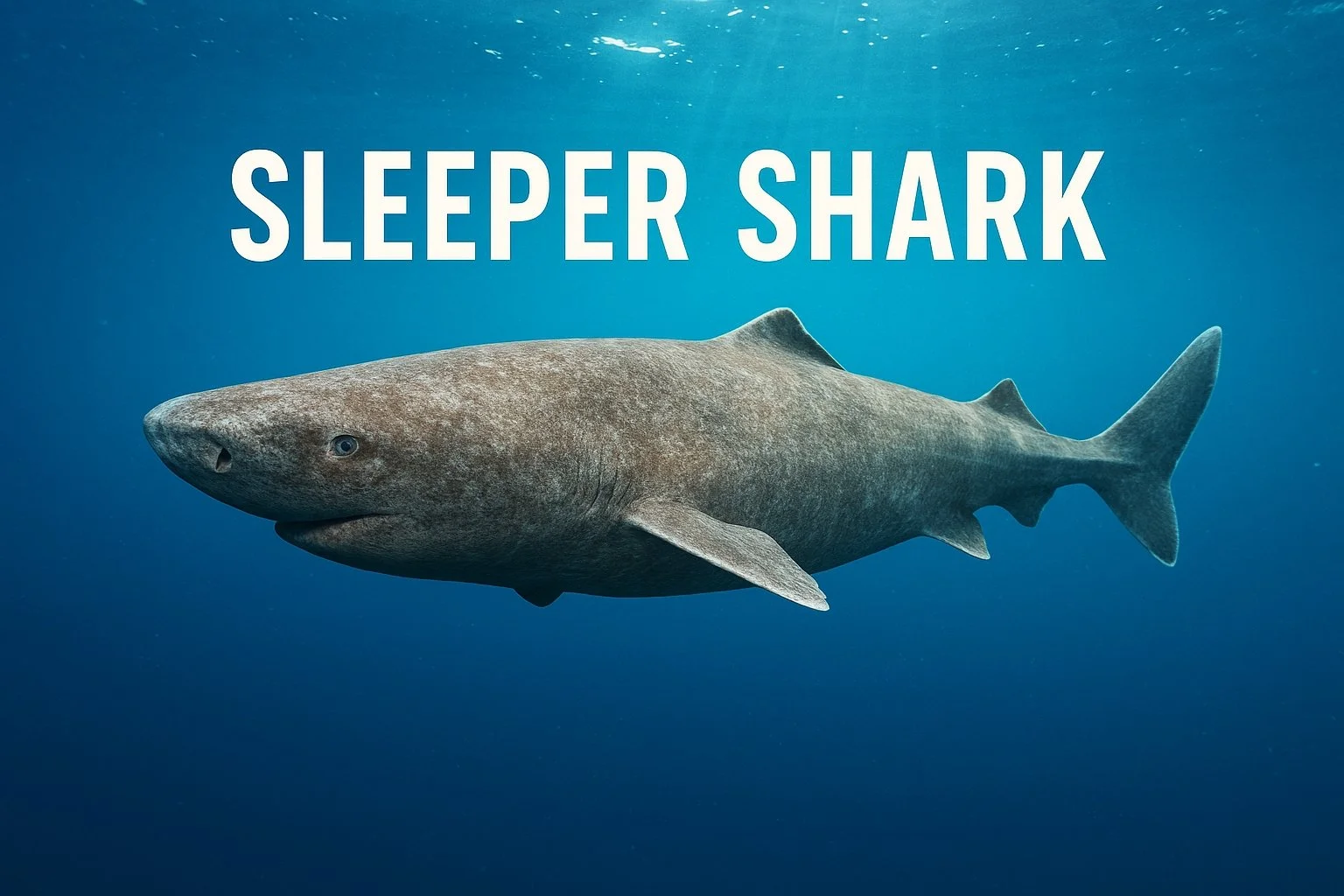
In January 2025, scientists with the Minderoo‑UWA Deep‑Sea Research Centre captured something no one expected: a massive sleeper shark gliding through the near‑freezing waters off the South Shetland Islands — the first confirmed shark ever filmed in Antarctic waters (Jamieson, 2026). This sighting challenges long‑held assumptions that sharks cannot survive in the Southern Ocean’s extreme cold.
The shark, estimated at 10–13 feet long, appeared at a depth of ~490–500 meters, where the water hovered around 1.27°C (34°F) — a temperature previously thought too cold for sharks to function (Yahoo News, 2026; AP News, 2026).
Based on body shape, movement, and depth, researchers believe the animal is a Southern Sleeper Shark (Somniosus antarcticus), a close relative of the Greenland shark (Smithsonian Magazine, 2026). These sharks are known for:
- Extremely slow metabolism
- Lifespans possibly exceeding 250–400 years
- Slow growth — less than 1 cm per year
- A “slow‑motion” lifestyle that conserves energy in cold, food‑scarce environments
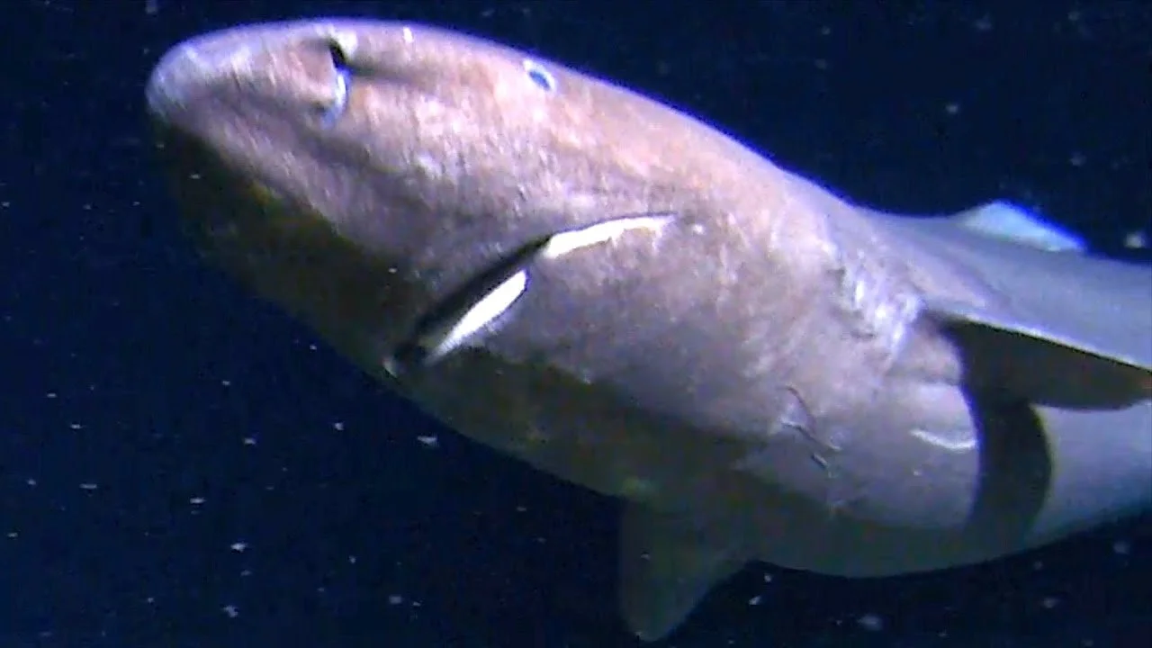
How Does a Sleeper Shark Survive Antarctica?
Sleeper sharks possess biochemical adaptations that allow them to function in icy water:
- High levels of TMAO (trimethylamine N‑oxide), which stabilizes proteins at freezing temperatures
- High urea concentrations that help maintain osmotic balance
- A metabolism so slow they move at under 2 mph
- Opportunistic feeding on fish, squid, and sinking carcasses of whales and giant squid
These traits make them “true polar sharks,” capable of thriving where most predators cannot (Ebert, 2026).
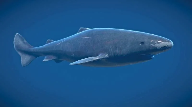
New 2026 Updates: What Scientists Are Learning Now
Recent articles from February–March 2026 reveal several important updates:
This may be the southernmost shark ever recorded.
Multiple independent experts confirmed no shark had ever been documented this far south before (AP News, 2026; Daily Express, 2026).
Climate change may be influencing shark distribution.
Some scientists suggest warming oceans could be pushing deep‑sea species farther south, though data is limited due to Antarctica’s remoteness (Kyne, 2026).
The shark may have been there all along — we just never saw it.
Because cameras can only be deployed during the Antarctic summer, 75% of the year goes unobserved, meaning sleeper sharks could have been present for decades without detection (Polar Journal, 2026).
The sighting raises new questions about deep‑sea connectivity.
Genetic studies of sleeper sharks in other oceans show they may travel thousands of kilometers at depth, possibly using currents like the Antarctic Circumpolar Current to disperse (Arabian Post, 2026).
This sleeper shark is more than a surprising video clip — it’s a reminder of how little we know about the deep sea. Antarctica’s abyss is one of the least‑studied ecosystems on Earth, and each new discovery reshapes our understanding of marine life, climate change, and species resilience.
For conservationists like us at The Ripple Effects, this sighting reinforces a powerful truth:
The ocean still holds mysteries — and protecting it means protecting stories we haven’t even discovered yet.
References and Further Readings
- Yahoo News (2026). Shark discovered in Antarctic waters has survival superpowers.
https://news.yahoo.com/shark-discovered-antarctic-waters-has-survival-superpowers (news.yahoo.com in Bing)
- Associated Press via Yahoo (2026). A massive shark just showed up somewhere scientists never expected to find one.
https://news.yahoo.com/massive-shark-showed-up-somewhere-scientists-never-expected (news.yahoo.com in Bing)
- Arabian Post (2026). Antarctic sleeper shark reveals extreme survival traits.
https://thearabianpost.com/antarctic-sleeper-shark-survival-traits (thearabianpost.com in Bing)
- Daily Express (2026). Antarctica scientists make terrifying discovery 500 metres below ice.
https://www.express.co.uk/news/science/antarctica-scientists-terrifying-discovery-shark (express.co.uk in Bing)
- Smithsonian Magazine (2026). First Known Footage of an Elusive Southern Sleeper Shark in Antarctica.
https://www.smithsonianmag.com/science-nature/first-footage-southern-sleeper-shark-antarctica (smithsonianmag.com in Bing)
- Polar Journal (2026). Shark filmed in Antarctica for the first time.
https://www.polarjournal.org/shark-filmed-in-antarctica-first-time (polarjournal.org in Bing)
- Futura Sciences (2026). Scientists Film a Shark in Antarctic Waters for the First Time.
https://www.futura-sciences.com/planet/antarctic-shark-filmed-first-time (futura-sciences.com in Bing)
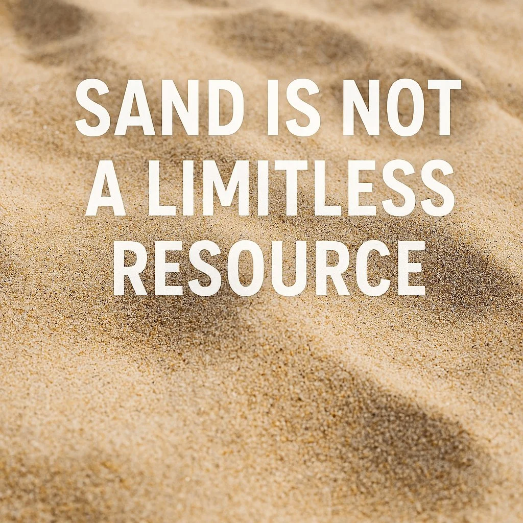

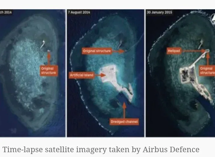
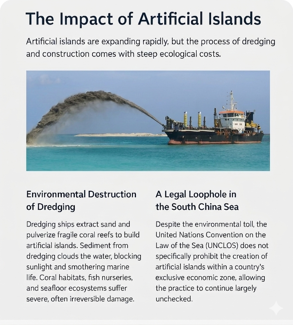
A split image showing an artificial island above water and marine life below, including a shark in the graphic highlights ow sand and rock extraction harms ocean ecosystems. Text warns about $500 billion loophole and the true cost to the ocean
China’s construction of artificial islands in the South China Sea has accelerated again this year, and with every new landmass, the ocean loses another irreplaceable ecosystem. What looks like strategic expansion from above is, beneath the surface, an unfolding ecological collapse.
How These Islands Are Built — and What Gets Destroyed
Artificial islands don’t rise from empty water. They begin with dredging, where massive ships vacuum sand from the seafloor and pulverize coral reefs to create building material. This process destroys living coral structures, fish nurseries, seagrass beds, and the burrowing species that keep the seafloor healthy. A single dredging operation can erase a reef system that took centuries to form.
Coral Reefs: The First Casualties
Coral reefs are living organisms. When dredgers hit them, the coral skeleton shatters instantly. Sediment blankets the reef, blocking sunlight and suffocating the polyps that keep the reef alive. The structure collapses, taking thousands of species with it. Sediment plumes drift for miles, killing coral that wasn’t even touched by machinery. What survives the initial destruction often dies from the fallout.
The Sand They Take — and the Species Buried With It
Ocean sand is alive. It’s made from crushed coral, shells, parrotfish‑made sand, microorganisms, and tiny burrowing creatures. When dredgers vacuum it up, clams, worms, and crustaceans die instantly. Rays, angel sharks, and flatfish lose their camouflage grounds. Seagrass beds collapse because their anchoring sand is removed. Juvenile fish lose their nurseries, breaking the food chain from the bottom up. The ocean floor becomes a barren desert.
The Final Blow: Dumping Land Sand Into the Sea
After dredging, China reinforces these islands with land sand — a material that does not belong in the ocean. Land sand is sharper, heavier, chemically different, and formed by wind instead of waves. When it enters the ocean, it behaves like a pollutant.
It settles in thick layers that smother coral, seagrass, and bottom‑dwelling species. It disrupts ocean chemistry because ocean sand is calcium‑based while land sand is quartz‑based. This changes pH, nutrient flow, and the micro‑ecosystems marine life depends on. Sand‑dependent species like rays, flounder, angel sharks, and countless invertebrates cannot survive in it. Land sand is too heavy and too coarse — it crushes instead of supporting.
It also destabilizes the islands themselves. Land sand erodes quickly, forcing China to dredge more material to reinforce the islands, creating a cycle of destruction with no natural endpoint.
A Global Warning
These islands aren’t just military outposts. They are ecological graveyards. The world sees new runways and territorial claims. The ocean sees dead coral, buried nurseries, collapsed food webs, poisoned sand, and species pushed closer to extinction. This is not just a regional issue. It’s a global one.
The Ocean Remembers
Every artificial island leaves a scar the ocean cannot heal on its own. Every dredged reef. Every buried species. Every grain of land sand that never belonged there. And the ripple effects will be felt far beyond the South China Sea.
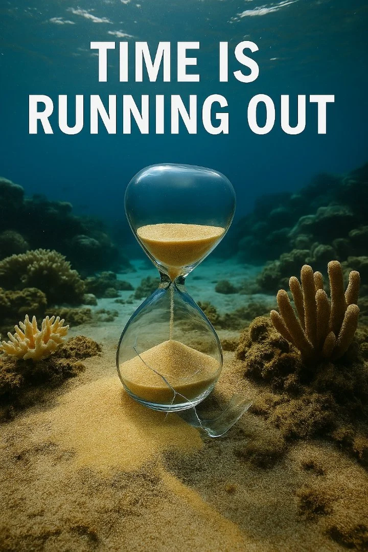
China’s Artificial Islands Are Expanding-and the Ocean is Paying the Price.
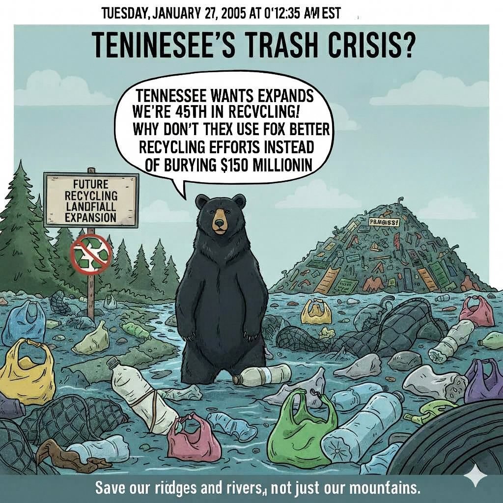
Fill Your Stanley at the Local River: The High Cost of the Southeast’s Trash Obsession
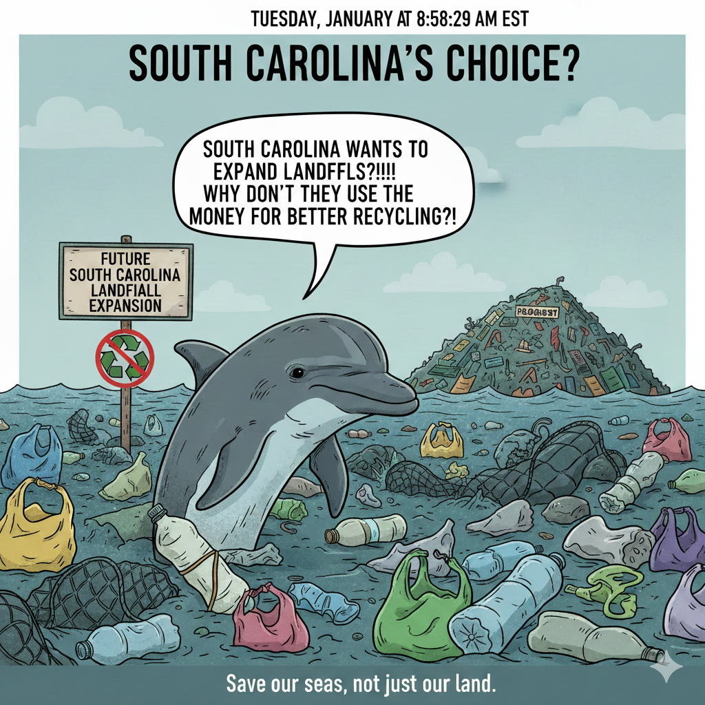
In 2026, the “reusable bottle” is the ultimate status symbol. We carry our Stanleys, Owala’s, and Yetis everywhere, obsessed with staying hydrated and healthy. But have you looked at the water source lately?
While we’re busy picking out the next limited-edition color, states like Tennessee and South Carolina are busy deciding where to bury hundreds of acres of trash. The problem? Those trash piles don’t stay put. They leak into the rivers that fill our taps and eventually reach the oceans that sustain our planet.
The Great Southern Landfill Land-Grab
This isn’t just one city’s problem. It’s a regional epidemic:
In South Carolina: Developers have proposed expanding landfills into over 100 acres of pristine wetlands in places like Horry County. Wetlands are nature’s kidneys- they filter our water. Replacing them with trash is like removing your own filters and replacing them a sponge soaked in toxins.
In Tennessee: It is currently ranked 48th in the nation for recycling. They are running out of spaces so fast that Middle Tennessee has less than a decade before it hits a “trash wall”.
The Shared Impact: Whether it’s the Tennessee River flowing toward the Gulf or the Waccamaw River flowing toward the Atlantic, the result is the same: toxic runoff (leachate) and microplastics.
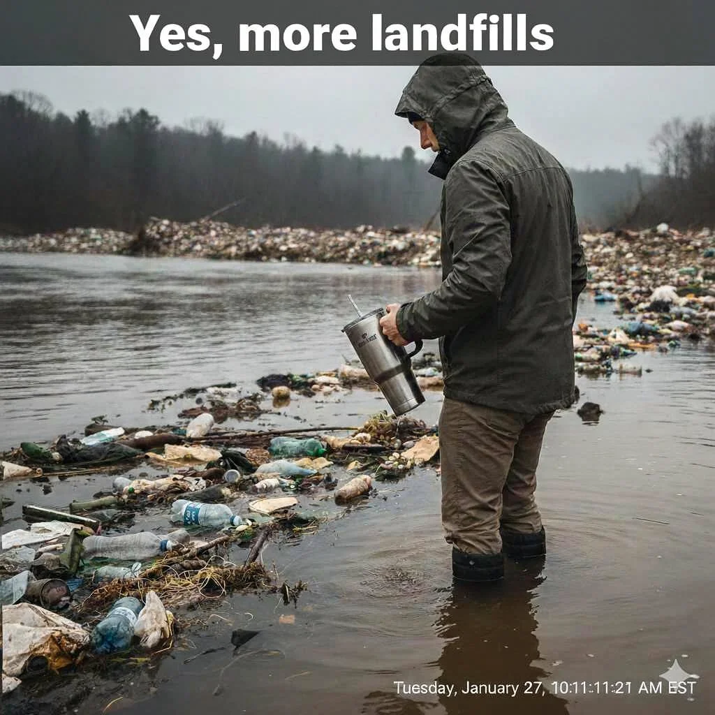
Leachate: The “Secret Ingredient” in Your Water
When it rains on a landfill, it creates Leachate- a cocktail of heavy metals, chemicals, and PFAS (the “forever chemicals” found in many plastics).
Runoff is Real: No liner is perfect forever. eventually, these chemicals seep into the groundwater.
The Necessity of Life: Water is the one thing we can’t live without. Yet, we are prioritizing “cheap” trash disposal over the safety of our watersheds.
The Money Trail: Who is actually paying?
People think landfills are the “cheaper” option. That is a financial lie.
1. The $150 million waste: In Tennessee alone, we bury $150 million worth of aluminum and plastic every year. We are literally paying to hide resources that could be sold to create local jobs.
2. The Long-Term Debt: When a landfill closes, the cost of monitoring it for leaks falls on the taxpayers for decades. The private companies take the profit now, you take the bill later.
The Solution: Fund the Future, Not the Hole. We don’t need more 100-acre dump sites. We need Recycling infrastructure which creates 10x more jobs than landfills. Legislation: Supporting acts like the Tennessee Waste to Jobs Act or South Carolina’s coastal protection bills.
The Choice: A Clear Future or a Toxic Debt?
Our reusable bottles are only as healthy as the water we put in them. We’ve turned hydration into a status symbol, yet we continue to trade our “nature’s kidneys” for more space to hide our waste. This isn’t just an environmental tragedy; it’s a financial lie. By choosing landfills over recycling, we aren’t just losing $150 million in resources- we are signing a blank check for future generations to clean up our toxic debt.
The “trash wall” is coming, and a limited-edition color won’t protect us from the leachate in our taps. It is time to stop investing in holes in the ground and start demanding the infrastructure that keeps our water clean and our economy circular. Don’t just carry the bottle-protect the source and save our seas; they cannot save themselves from us.
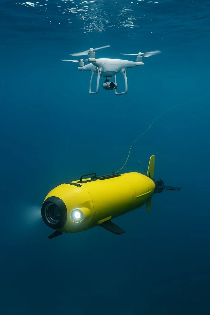
How Robotics and Drones Are Transforming Ocean Conservation
The ocean covers more than 70% of our planet, yet much of it remains unexplored and vulnerable. Illegal fishing, pollution, and climate change threaten marine ecosystems daily. Now, robotics and drones are emerging as powerful allies, offering new ways to monitor, protect, and understand the ocean. These technologies extend human reach, reduce risk, and provide real time insights that can safeguard fragile ecosystems.
Fighting Illegal Fishing is one way of there assistance. Illegal, unreported, and unregulated(IUU) fishing is one of the greatest threats to marine biodiversity. Traditional patrol ships are costly and limited in scope, but drones and autonomous vehicles are changing the game.
AI-powered drones can patrol coastlines, detect suspicious vessels, and monitor fishing activity in real time. equipped with thermal imaging and radar, they provide evidence to prosecute illegal operators.
Autonomous underwater vehicles (AUVs) track nets and identify unreported catches, helping authorities enforce sustainable fishing laws. These tools reduce reliance on human patrols, cut costs, and expand coverage making enforcement more effective than ever before.
By combining robotics with satellite data, conservationists can create a digital sheild around vulnerable waters, protecting species from exploitation.
By opening windows into these hidden worlds, robotics expand our knowledge of biodiversity and resilience. Robots explore hazardous zones humans cannot reach, reducing risk to divers and researchers. Missions cost less and cover more ground than traditional vessels. High-resolution imagery and sensor data provide unprecedented detail. From aquaculture inspections to climate monitoring, robotics are reshaping marine science and policy. These technologies are already being deployed in Artic research, coral reef monitoring, and fisheries management, proving their versatility across ecosystems.
Robotics and drones extend human vision into places once thought unreachable. Used responsibly, they are not tools of exploitation but partners in discovery. They remind us that technology, when aligned with conservation, can amplify human creativity and safeguard the planet’s most fragile ecosystems.
Exploring Volcanic Vents and Deep-Sea Habitats
The deep ocean is one of Earth’s last frontiers. Hydrothermal vents, volcanic ridges, and abyssal plains host life forms adapted to extreme conditions. Until recently, these habitats were nearly impossible to study.
Remotely Operated Vehicles(ROVs) now dive thousands of meters, capturing high-resolution footage of vents and rare ecosystems.
Dual-mode drones like MEDUSA can both fly and dive, measuring water quality and climate changes in Artic seas. This versatility allows scientists to monitor ecosystems across multiple environments in a single mission.
Robotics are also mapping volcanic vents, uncovering new species and helping us understand how these ecosystems contribute to global nutrient cycles.
The High Seas Treaty: What , Who, and Why: Latest News
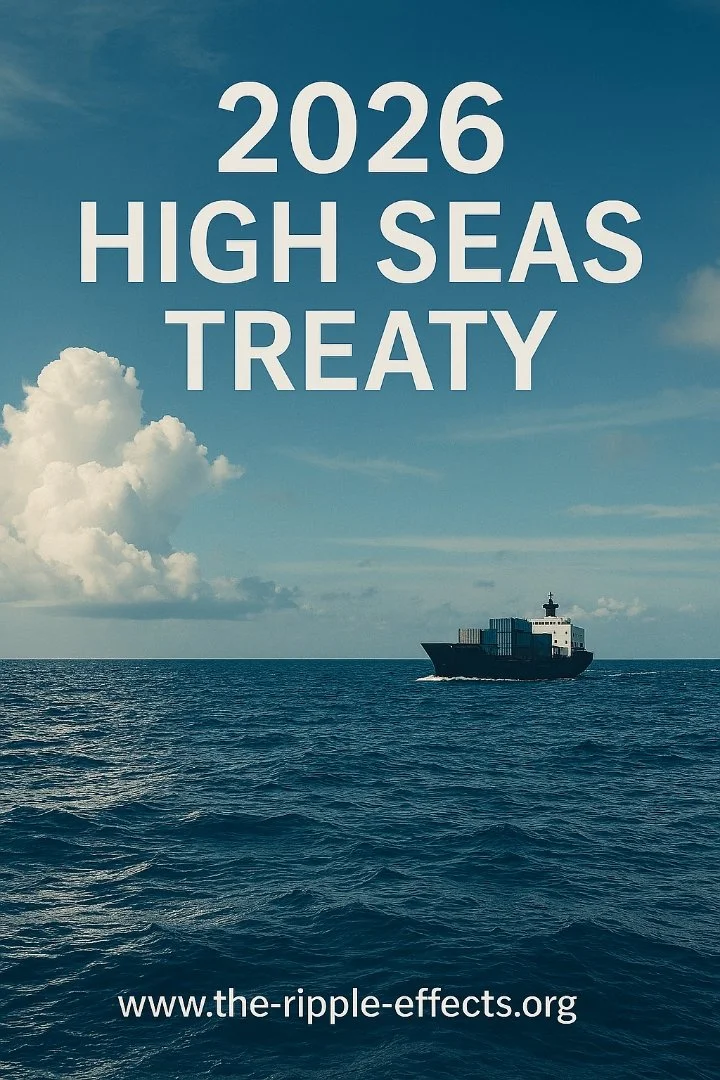
The High Seas Treaty officially entered into force this week, marking a major step toward protecting the parts of the ocean that lie beyond any country’s borders. Many people are asking simple, practical questions: What does this treaty actually do? Who enforces it? And how does it protect sharks, whales, and other wildlife?
The high seas are everything beyond 200 miles from any country’s coastline. No nation owns this space. For decades, it has been a place where illegal fishing, shark finning, and destructive practices could happen with almost no consequences.
What the Treaty Actually Does
It’s a global agreement where countries finally said they need rules to protect the parts of the ocean nobody owns. The treaty creates protected areas. Countries can now designate parts of high seas as no-fishing, no-mining, and no-drilling zone. It requires environmental checks, any major activity must be reviewed to ensure it won’t harm ecosystems.
It also increases transparency, ships must report what they’re doing instead of disappearing into the dark. The treaty also connects countries. Nations must share satellite tracking, vessel data, and enforcement actions.
What the Treaty Does NOT Do
It does not give countries ownership of the ocean. No one gains new territory or new rights. It does not control what countries do in their own waters. China, Korea, Japan, and others still control their own 200-mile zones.
Shark finning in those waters remains legal unless those nations choose to ban it. The treaty also does not create an ocean police force, this is no single global patrol boat.
So Who Enforces It?
Enforcement happens through existing systems that are now required to work together. Port countries: if a ship docks with illegal catch, the port can seize the catch, detain the vessel, fine the company, or ban it from returning. Flag countries: Every ship sails under a country’s flag. That country must investigate violations, punish illegal operators, and cooperate internationally.
There is also, Satellite monitoring: countries share tracking data, making it harder for illegal vessels to hide. Finally, there’s Coast guards and navies: they can board ships, inspect them, and take action when violations are suspected.
Why This Matters for the Ocean
Before this treaty, the high seas were a free-for-all. Now destructive fishing can be banned in protected zones. Migratory routes for sharks and whales can be legally protected. Illegal operators can be tracked, caught, and punished.
Countries must cooperate instead of looking the other way. It doesn’t fix everything, especially shark finning in national waters, but it closes the biggest loophole on Earth: the lawless two-thirds of the ocean.
The Bottom Line
The High Seas Treaty is the world finally agreeing to stop treating the open ocean like a dumping ground and start treating it like something bigger, more important, something worth protecting. Its not perfect, but it’s a turning point and a powerful start to 2026.
End of the Year: 2025 December’s Deep Sea Discoveries
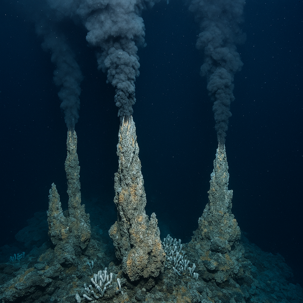
Dark Oxygen: A New Source of Deep-Sea Oxygen Found 4,000 Meters Down
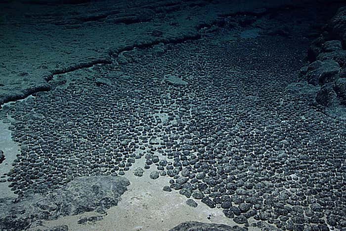
Scientists studying the Clarion-Clipperton Zone in the Pacific Ocean have documented a phenomenon now called “dark oxygen,” where polymetallic nodules on the seafloor appear to generate oxygen in total darkness. The discovery began almost a year ago, when researchers repeatedly recorded unexpected oxygen spikes while sampling the seafloor at depths around 4,000 meters. With no sunlight at these depths, photosynthesis could not explain the readings.
In 2021 and 2022, scientists enclosed small areas of the seafloor inside experimental chambers to measure oxygen levels directly. Instead of the expected decline in oxygen caused by microbial consumption, the chambers showed rising oxygen levels. This suggested that something on the seafloor was producing oxygen in the absence of light. Suspecting polymetallic nodules was involved, these potato sized rocks contain manganese, nickel, cobalt, and other metals.
Laboratory tests showed that nodules can generate small electrical currents when placed in seawater like solutions. These currents may be strong enough to split water molecules into hydrogen and oxygen, acting like natural geobatteries. Measurements showed voltage readings ranging from a few millivolts up to 950 millivolts, approaching the threshold needed for water splitting. If confirmed, this process would represent a new light independent pathway for oxygen production on the seafloor. Scientists refer to this specific mechanism as nodule-associated dark oxygen production.
The implications extend beyond basic chemistry. Polymetallic nodules are central to ongoing debates about deep-sea mining. If these nodules play an active role in oxygen cycling, removing them could alter local biogeochemistry and affect deep sea ecosystems that rely on stable oxygen conditions. Researchers note that findings come at a critical moment as international regulations for mining in the Clarion Clipperton Zone are being developed.
Dark oxygen remains an active area of investigation, but the evidence so far suggests the deep ocean may host chemical processes that have gone unnoticed for decades. For ocean science, it adds another reminder that the seafloor is not a static environment. For conservation, it raises new questions about how industrial activity could affect systems we are only beginning to understand.
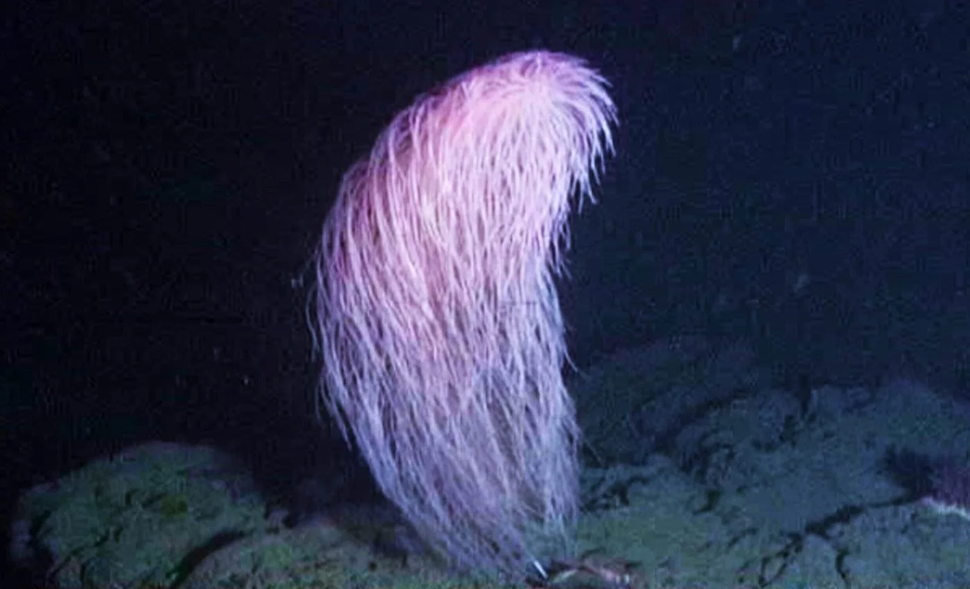
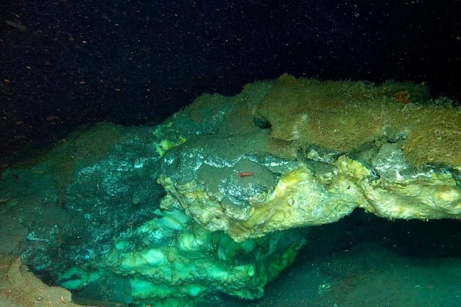
Iridogorgia Chewbacca a newly named deep-sea coral that is making headlines this month, not for size or age, but for its unusual appearance. In December 2025, researchers formally described Iridogorgia Chewbacca, a rare coral species whose long, glossy, hair-like branches resemble the silhouette of Chewbacca from Star Wars. The name is now official, but the species itself has been hiding in the deep for years. The first known specimen was photographed in 2006 during a remotely operated vehicle (ROV) dive off Molokai, Hawaii, growing on a rocky slope thousands of feet below the surface. A second specimen was later collected in the Mariana Trench region, confirming that the species occupies some of the most remote and least-surveyed areas of the Pacific. These corals live in cold, dark waters where sunlight never reaches and temperature stay just above freezing. I. Chewbacca belongs to a family of deep-sea corals known for their tall, branching structures, but this species stands out. Its branches can reach up to 4ft in height, arranged in loose spirals that give the coral a shaggy, windswept look. Each branch is made up of hundreds of tiny polyps that function together as a single organism. Only two specimens have ever been collected, making it one of the rarest documented corals in its group. Corals like Chewbacca grow extremely slowly sometimes only millimeters per year which means individual colonies may be centuries old. Their presence can indicate long term stability in deep habitats, while their vulnerability highlights how easily these ecosystems can be damaged by deep-sea mining, trawling, or climate driven changes in ocean chemistry. Even with decades of ROV surveys, new species continue to appear in areas once thought barren. Iridogorgia Chewbacca may have earned attention because of its Hollywood nickname, but its scientific value is far more important. It represents another reminder that the deep ocean still holds species we’ve barely begun to study and the importance of protecting these habitats.
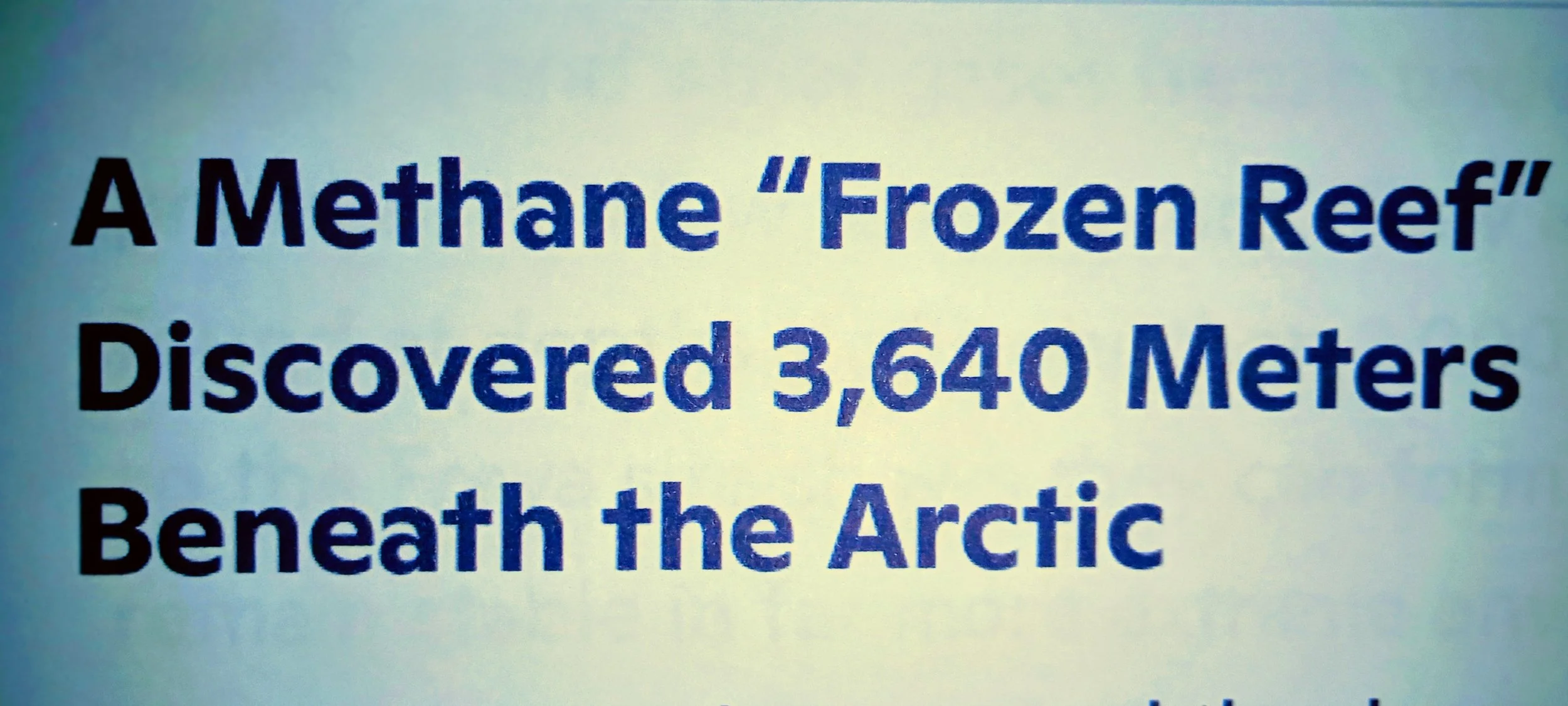
Scientists have documented the deepest gas hydrate cold seep ever found in the Artic, revealing a previously unknown ecosystem thriving 3,640 meters below the surface on the Molloy Ridge in the Greenland Sea. The site, called Freya Hydrate Mounds, was identified during the Ocean Census Artic Deep- EXTREME24 expedition and published in December 2025 in Nature Communications. This discovery pushes the known depth limit for gas hydrate outcrops nearly 1,800 meters deeper than any previously recorded site. Gas hydrates are ice like solids formed when methane and other gases freeze under high pressure and low temperature. They are usually found at depths shallower than 2,000 meters, so the Freya site shows they can form and remain stable in far more extreme environments than expected. The Freya mounds form a compact field of hydrate structures, collapse pits, and small ridges. ROV surveys documented active methane seepage, crude oil emissions, and a dynamic landscape where hydrate mounds appear to form, destabilize, and collapse over time. Researchers also recorded methane flares rising more than 3,300 meters through the water column, among the tallest ever observed globally. The gases at the site are thermogenic, originating from Miocene aged sediments. This indicates deep geological fluid migration over millions of years and shows that the system is shaped by tectonic activity, heat flow, and long-term environmental change. Despite the extreme depth and cold, the Freya site supports a dense chemosynthetic community. Observed species include siboglinid tubeworms, maldanid worms, snails, amphipods, and other seep associated organisms. Many of these species are also found at Artic hydrothermal vents, revealing an unexpected ecological connection between deep sea habitats once thought to be isolated from one another. Scientists say the Freya Hydrate Mounds provide an ultra deep natural laboratory for studying methane stability, deep carbon cycling, and how Artic ecosystems respond to environmental change. The findings also highlight the need to protect these habitats from future deep-sea mining or industrial activity, as they may play a critical role in the biodiversity of the deep Artic.
NASA and ESA Launch Sentinel-6B to Extend Global Sea-Level Records
NASA and its European partners have launched Sentinel-6B, the newest satellite designed to monitor global sea levels with the high precision. The mission continues a decades-long effort to track ocean height, temperature, and circulation patterns from space. Sentinel-6B lifted off on November 16, 2025, and is now in orbit as the primary reference satellite for global sea-level measurements.
Sentinel-6B is part of the Copernicus Sentinel-6/Jason-CS mission, a collaboration between NASA, ESA, EUMETSAT, NOAA, the European Commission, and CNES. It succeeds its twin satellite, Sentinel-6 Michael Freilich, which launched in 2020. Together, the pair extend a sea-level record that began in 1992 with the TOPEX/Poseidon mission and continued through the Jason-1, Jason-2, and Jason-3 satellites.
The satellite carries a radar altimeter that sends signals to the ocean surface and measures the return time to calculate sea-surface height. It also includes an advanced microwave radiometer to correct for atmospheric water vapor, improving the accuracy of sea level measurements. Sentinel-6B will map about 90 percent of Earth’s ice-free oceans every 10 days, providing consistent global coverage.
In addition to sea-level monitoring, Sentinel-6B collects vertical profiles of atmospheric temperature and humidity using radio-occultation techniques. These data help improve weather forecasting, hurricane prediction, and climate modeling. NASA notes that the satellite’s measurements also support coastal planning, flood preparedness, and long-term climate assessments.
The mission is designed to operate through at least 2030. Its data will help scientists track how quickly oceans are rising, how heat is distributed across the planet, and how ocean circulation patterns are shifting. These long-term records are essential for understanding changes in coastal risk, storm intensity, and global climate trends.
Sentinel-6B’s launch marks the continuation of one of the most important climate-monitoring efforts in Earth science. With nearly four decades of continuous sea-level data, the mission provides a clear view of how the ocean is responding to warming temperatures and melting ice. The new satellite ensures that this record will remain uninterrupted for years to come.
Gold Rush, Holiday Gift from
the Ocean
December 2025 felt like the ocean was handing us gifts, a treasure hunt beneath the waves. Scientists announced the discovery of more than 866 new marine species, a surge so big it’s already being called an “Ocean Gold Rush.” From shadow reefs to the deepest trenches, the sea reminded us it still holds mysteries waiting to be uncovered - and that it’s still resilient enough to surprise us.
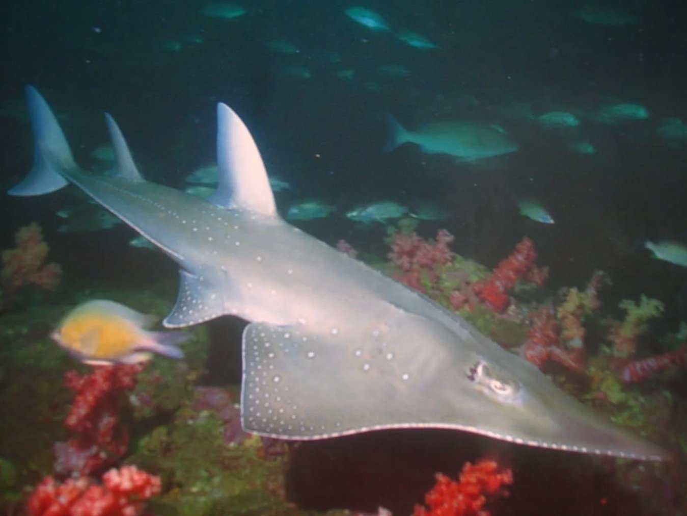
One of the discoveries that caught my attention came from Monzambique and Tanzania: the funky guitar shark. It looks like a mash-up between a ray and a shark, with a flat body and a tail that gives it a silhouette like a guitar. Only about 38 species of guitar sharks are known worldwide, and many are endangered, so seeing one thriving in these waters feels like hope. It’s a reminder that even the strangest shapes have a place in the ocean’s story.
The discoveries weren’t limited to one region. In the Red Sea, new reef species were cataloged, adding to the vibrant biodiversity of those warm waters. In the deep trenches, strange creatures like parasitic isopods and carnivorous bivalves turned up at depths of 6,000 to 8,000 meters. Altogether, expeditions spanned ten regions, from coral reefs to nearly 5,000 meters down, involving more than 800 scientists across 400 institutions. It was a global effort, and the results were staggering.
What struck me most is the reminder that the ocean isn’t just struggling under the weight of human impact - it’s still fighting to recover. Every new species discovered is proof that protecting marine ecosystems isn’t the only about saving what we already know. It’s about safeguarding what we haven’t even met yet. The guitar shark, the deep-sea snailfish, the countless tiny crustaceans - they’re all part of a living library we’re only beginning to read.
December’s discoveries show us that the ocean is still resilient, still mysterious, and still worth every ounce of protection we can give it. When humanity steps up - through treaties, bans on harmful plastics, or simply paying attention - the sea responds with resilience. That’s news worth celebrating, and it’s a story worth telling.
For me, this “Ocean Gold Rush” feels like a turning point. It’s not just about the numbers - 866 species, 10 regions, thousands of meters deep. It’s about the feeling that the ocean is still alive with possibility. And if we protect it, maybe we’ll keep discovering funky silhouettes like the guitar shark for generations to come.

Local Legend goes too soon, Remembering Jean Beasley….
Jean Beasley didn’t just protect sea turtles-she protected promises. After losing her daughter Karen to leukemia, Jean honored her final wish by founding a sea turtle rescue center on Topsail Island, North Carolina. What began as a small act of love grew into a sanctuary that healed thousands of turtles and inspired countless people. Jean’s hands were always busy-guiding hatchlings to the sea, comforting injured animals, and teaching children that every life, no matter how small, matters.
She believed conservation was about connection, not just care. Her impact is extraordinary. She founded the Karen Beasley Sea Turtle Rescue and Rehabilitation Center into a 13,000-square-foot hospital and education hub in Surf City. With more than 245,000 hatchlings safely reaching the ocean, and at least 1,600 turtles treated and released back into the wild. She was honored in 2022 with the Thomas L. Quay Wildlife Diversity Award for her long-standing leadership in conservation (North Carolina Wildlife Resources Commission, 2022).
Jean Beasley passed away in December 2025 at age 90, surrounded by loved ones. Her story is one of resilience, hope, and the power of turning personal loss into global impact. The center continues her mission, ensuring that her daughter’s wish lives on in every hatchling sprinting toward the waves.
Latest News: Great White Sharks on the Move
Latest News: Great White Sharks on the Move
This December has been full of activity for the Atlantic’s great white sharks. OCEARCH’s tracking program has reported several giants making their way south, covering thousands of miles and reminding us of the resilience of these Apex predators. Here are the latest updates on four extraordinary individuals.
Goodall at 13 feet long and weighing nearly 1,400 lbs. is a powerful female shark tagged off Nova Scotia in September. Since then, she has traveled more than 2,100 miles, recently pinging off Amelia Island and Jacksonville Beach in Florida. Named in honor of Dr. Jane Goodall, her journey highlights the importance of tracking technology in understanding how sharks migrate seasonally and adapt to changing waters.
Contender is one of the largest males ever tagged by OCEARCH, measuring almost 14 feet and weighing over 1,650 lbs. Earlier this month, he was detected off South Carolina, continuing his long journey southward. Since tagging, Contender has traveled nearly 5,000 miles, showing the incredible scale of these migrations. His size and stamina make him a standout in the program, offering scientists valuable data about how mature males use the Atlantic corridor.
Ripple is an 11-foot, 778-pound shark who has surfaced in Florida's Gulf waters. Tagged in Nova Scotia just months ago, he has already covered nearly 2,900 miles. His name reflects the idea that small ripples can grow into wave - a fitting symbol for conservation and awareness. Ripple’s movements through the Gulf remind us that younger sharks are just as vital to track, since their parents may reveal new feeding grounds and developmental stages.
Ernst is another impressive traveler, a 12-foot, 1,000-pound female who has pinged multiple times off Southwest Florida near Naples and the Everglades. Sine October, she has traveled more than 2,600 miles, zig-zagging through Gulf waters and demonstrating the wide range these sharks cover. Ernst’s journey underscores the important of protecting diverse habitats, from coastal shallows to deeper offshore zones.
Why These Updates Matter
These updates matter because together, these four sharks show the strength and adaptability of the species. Their migrations connect northern tagging sites in Nova Scotia with southern wintering grounds in Florida and the Gulf. By following their movements, scientists gain insight into feeding, breeding, and survival strategies.
The good news is that data suggests the Atlantic great white population is stable or even increasing - a hopeful sign for conservation. Each ping from Goodall, Contender, Ripple, and Ernst is more than just a dot on a map; it’s a reminder that protecting apex predators protects the entire ocean ecosystem.
Why Great Whites Matter to Me
For me, the great white is more than a headline or a tracking ping - it’s a symbol of resilience and restoration. These sharks embody the balance of the ocean, reminding us that protecting apex predators means protecting the entire web of life beneath the waves. Their journeys inspire my work with The Ripple Effect, showing how science and storytelling can spark care and action. Every time I share their updates, I hope readers feel the same awe I do - and recognize that safeguarding these giants is safeguarding our own future.
As these giants glide through Florida’s waters this winter, they carry stories of restoration and courage. Their journeys are living proof that when we care for the ocean, we create ripples of change that reach far beyond the waves.